
Pacific Ocean Crossing on a Catamaran! What Makes it Possible?
As an Amazon Associate, we earn from qualifying purchases. We may also earn commissions if you purchase products from other retailers after clicking on a link from our site.
Crossing the Pacific ocean is a challenging but exhilarating experience for any sailor, it is a must-do for circumnavigators and the path between the Americas and Australia. The Pacific Ocean can be rough at times and therefore it’s worth discussing whether or not a catamaran is suitable for this journey!
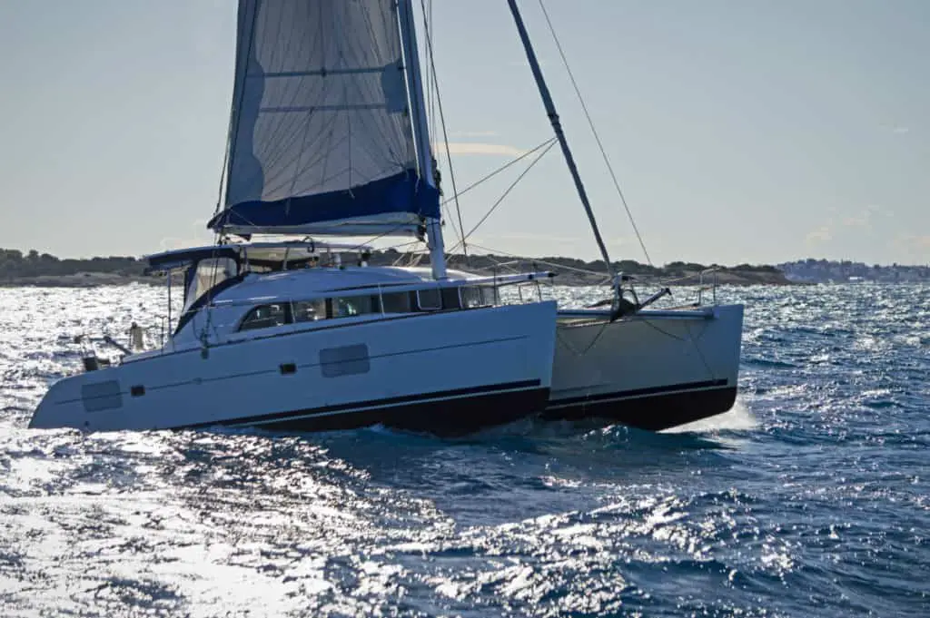
A Catamaran is an excellent vessel for crossing the Pacific Ocean. Catamarans make suitable vessels for long sea journeys as they are spacious, stable, and move at high speeds. Their stability makes them resist capsizing, the high speeds allow for outrunning storms and the interior space allows for enough crew and food.
In this article, I will go over the advantages of sailing across the Pacific on a catamaran. I will also discuss the potential length of time your voyage would take, the risks associated with cruising this area, and whether it’s feasible to do it alone.
Table of Contents
Can a Catamaran Cross the Pacific Ocean?
Catamarans are ideal for crossing the Pacific. The vessels are an ideal choice for any long journey, even crossing the Pacific, thanks to their size, large living area, high stability, and high speeds. The boat’s length, which should be at least 30 feet (9.1 m) long, is a significant consideration.
Crossing the ocean is no easy feat, even for the most experienced sailors. The good news is that a catamaran of a decent size, that is, above 35ft long, can handle the long journey.
You can make this journey on a 35 feet boat but preferably it should be done with something bigger than 40 feet.
If you want to better understand why catamaran size matters I suggest you check out my other article named best sized and catamaran for ocean sailing .
However, when considering crossing the ocean, you must be well-prepared for all the obstacles you might run into. Having an experienced crew on board is vital to a successful journey.
Prepare Well for Your Pacific Ocean Crossing
A lot goes into preparing for such a long journey. Planning ahead and doing research is necessary to ensure that you are ready for your trip across the ocean . If you have experienced sailor friends, you can always ask them to provide any tips they might have. There are also numerous helpful resources online that can aid you in getting prepared for crossing the Pacific.
When it comes to sailing across the ocean, you must be sure of your skillset as a sailor. Also, it would be quite helpful if you have a group of equally experienced sailors to help you along your journey.
When you prepare well and take all precautions necessary, crossing the Pacific Ocean will be an exhilarating experience and one that you will remember for a lifetime.
Choose the Right Vessel
Choosing the right vessel for your journey is the first step in preparing for the journey. There are many great options to choose from, and a sailing catamaran is among the best choices. Many experienced sailors prefer sailing with a modern catamaran over other boats because of its comfort, stability, and high speed.
Larger catamarans have enough space to have a comfortable sail while not sacrificing performance. They are especially suitable for families that like to travel together. Large living spaces also provide excellent privacy if needed. This also allows enough room for a kitchen, making the cooking experience onboard more enjoyable.
With 40+ ft catamarans, there is enough space to fit several passengers and crew members.
Thanks to the dual hull design, catamarans are also much more stable than their monohull counterparts. This reduces the movement of the boat from waves and makes seasickness less likely, thus decreasing the risk of crew fatigue and sailor mistake.
The low drag of catamarans develops higher speeds, cutting down the time needed to reach your next destination. It will also increase the likelihood of running away from a storm or avoiding a squall. A faster boat, if only if you are not faster, will in the long run get you to your destination days ahead of time.
This can be the difference between sailing in horrible conditions or cruising into harbor on a sunny beautiful day.
Here’s a video of a passage between New Zealand and French Polynesia.
How Long Does It Take To Cross the Pacific on a Catamaran?
Crossing the Pacific on a catamaran takes between two weeks to more than a month, depending on a variety of factors. The beginning and ending points, the number of stops you make, wind and weather conditions, and the size and speed of your boat all contribute to the length of your journey.
There are numerous ways you can go about sailing across the Pacific. Depending on your starting point and destination, there are also several popular and widely-used routes available.
Every journey requires careful planning, and your Pacific journey will be no different. However, you have to be ready for some adjustments to your plans as you can’t predict everything that might happen on your journey.
Crossing The Pacific During The “Sailing Season”
There are certain times of the year when sailing across the Pacific is safest, such as during the so-called sailing season, or dry season.
This sailing season runs from May to October, when there is less chance of rain and cyclones.
When embarking on a journey across the Pacific Ocean, many people choose one of the following drop-off points: If you live on the West Coast of the United States, you can begin your journey near Seattle, at the US-Canada border of the Juan de Fuca Strait.
If you want to start in the south, go to Mexico, specifically Cabo San Lucas. The Panama Canal is the only way to get to the Pacific from the East Coast.
Plan Your Route Well
Whatever route and time of year you choose, the most important part of your preparation for the journey will be carefully planning your route. With the aid of modern technology, you can easily map out your ideal route, complete with stops at numerous islands scattered across the ocean. This will make your journey both interesting and enjoyable.
While you can estimate how long the journey will take, there is no way to predict precisely how much time you will spend crossing the Pacific. This is because there are far too many variables to consider when determining how long the trip will take. That’s why it is critical to keep an open mind, enjoy your journey, and not worry about exactly how long it will take you.
How Dangerous Is It To Sail Across the Pacific?
Sailing across the Pacific is one of the safer large ocean crossings you can do. Although, longer journeys come with a number of risks, including bad weather, accidents onboard, or worsening of any existing health issues. Most of these, though, may be mitigated with careful planning.
Every action we engage in has some level of danger associated with it. Some activities involve higher risks than others. Sailing over an ocean is a dangerous task, and many things can go wrong during your voyage. On the other hand, sailors are well aware of the level of risk they are taking on when venturing out onto the open seas.
Risks Associated With Sailing Across the Pacific
Most of the risks associated with sailing across the Pacific can be successfully overcome with proper expertise and thorough preparation.
Some factors, such as weather, are beyond your control; nevertheless, picking the appropriate time of year for your journey might help mitigate such dangers.
When traveling by car, navigating in bad weather conditions can be challenging. The risks that come with unfavorable weather conditions are increased exponentially at sea. Storms cause not just rain and wind but also waves and rough water conditions.
Health Issues
Another issue that you might encounter during your trip is related to any health issues or injuries of the crew or passengers on board. Most people are aware of their health-related concerns and are ready to manage them when sailing. However, health conditions can not always be predicted.
Numerous studies have been undertaken over the years concerning health issues that sailors may experience when living aboard the boat for extended periods of time.
The tight space on the boat, lack of exercise, poor nutrition, temperature fluctuations, and isolation from the outside world are all factors that put sailors at risk of developing numerous illnesses. According to one study, sailors on board are at a greater risk of dying from a myocardial infarction.
Risk of Injury
The risk of injuries is also high aboard. There are numerous tools and gear on a boat that could potentially be hazardous, especially for those who are not used to handling them. Additional factors that often cause injuries are related to sun exposure and lacerations from sharp objects.
No matter the weather or time of year, when you spend time in the open sea, your skin gets overly exposed to the sun and can get easily burnt or damaged. When spending a lot of time at sea, using sunscreen with a high Sun Protection Factor (SPF) is necessary to protect your skin from potential sun damage.
It’s a must to have a first aid medical kit on board in case of any injuries or illnesses that may happen to you or others on your boat. Additionally, knowledge about resuscitation and how to provide immediate medical assistance are essential skills to have for at least one of the people on board, if not for all.
Man Over Board (MOB) and Solo Sailing
Drowning is another potential concern when sailing across the ocean. It is fairly easy for a passenger or sailor to slip overboard by accident.
Current technologies and safety procedures make it possible (but incredibly hard usually) to quickly assist the individual and get them back on board.
However, there is still a substantial risk if the overboard mishap occurs in rough seas or at night. In most situations, however, drowning may be avoided by taking proper precautions.
When it comes to single-handed sailing, the dangers of drowning in the event of an overboard accident are substantially greater, as I will explain further below. Otherwise, drowning can be caused by other circumstances, such as injuries, boating accidents, or underlying health conditions that might render someone unconscious and cause them to fall overboard.
Ultimately, there’s nothing particularly worrisome about the Pacific ocean that cannot be applied to any other open seas. As such, if all safety precautions are taken before you set off on your journey, most of the associated risks can be easily mitigated.
Can You Sail Across the Pacific Alone (Shorthanded)?
While you can sail solo across the Pacific, taking such a long journey alone can be dangerous. For instance, you may undergo psychological and physical health issues, which a lack of sleep could exacerbate. And in case of an accident, the chance of death is also significantly higher.
Any seasoned sailor would advise against embarking on such a long solo boat trip without extensive experience. There are numerous reasons why sailing alone across the Pacific is not a good idea for everyone. The crossing includes both external challenges posed by the ocean and the psychological stress that you will experience.
Nothing can truly prepare you for what the open ocean has in store for you, even if you have years of experience taking short solo sailing trips.
However, the fact that many people strongly discourage solo ocean crossings does not mean that some sailors have not succeeded in such endeavors. This is an adventure of a lifetime!
The Hazards of Solo Ocean Crossing
There are many hazards associated with sailing across the Pacific Ocean alone. These include:
Falling Overboard
Marine technologies have advanced significantly in recent years, allowing boats to be equipped with various devices that are aimed at preventing accidents. However, the risk is still quite high; in case you fall overboard and your catamaran is set on autopilot, there’s not much you can do to save yourself.
Most offshore boats are equipped with a tethering system that attaches the sailor to the boat with a rope, this means that in case the sailor falls overboard he or she will still be attached to the boat. This is not a good situation, but it’s way better than the boat sailing away from you.
Another challenge you’ll encounter when taking such a long solo journey will be a lack of sleep. Catamarans, as well as other types of boats, require great attention to make sure they are operating correctly and that you’re headed the right way whilst avoiding traffic. Therefore, you won’t be getting enough sleep as you work to ensure that everything on board is in order.
When sailing, at least one person should always be alert to see any potential hazards in advance. With single-handed sailing, this becomes impossible. There are many guides on how a person can survive with little sleep, such as taking short naps often, but doing that for days on end can be taxing for the body.
With the lack of sleep comes numerous complications even under normal circumstances. Considering that you’ll be all alone on the high seas adds another challenging aspect. With lack of sleep, your stress levels will rise, and you might lose focus along with lack of energy, eventually leading you to a potential disaster.
Potential Safety Risk
While single-handed sailing over a long distance, you are not only being a danger to yourself but also putting other sailors at risk. While modern technology has allowed boats to detect any ships coming their way, the risk of collision still remains if the solo sailor is sleeping or otherwise preoccupied.
Also, not all boats will be detected by this type of warning system, or AIS (automatic identification system) as it is called.
Final Thoughts
To sum up, it’s quite possible to cross the Pacific ocean on a Catamaran. However, sailing alone on such a long journey is tough even for the most experienced sailors.
Here are Some of My Favorite Catamaran Cruising Resources
Thank you for reading this article. I hope you found it helpful as you hopefully start your sailing adventures. Here are some resources that I use as a sailor that I hope you’ll also find helpful. These are affiliate links, so if you do decide to use any of them, I’ll earn a commission. But in all honesty, these are the exact things that I use and recommend to everyone, even my own family. Sailboats: If you’re looking for the best boat to suit your needs, I would recommend a catamaran. If you’re interested, I can show you the differences between catamarans and other types of sailboats .
Books: For getting started, I really like Cruising catamarans made easy . It is actually a textbook from the American sailing association; it is used to get a cruising catamaran certification. There are some other great books, and I have compiled a list of books about cruising catamarans that you will find useful.
Communication: Being out on adventures, whether it be sailing or climbing mountains, good communications are essential to being safe. I recommend two things Google fi (incredibly simple cellular data all over the world) and Garmin inreach mini (for text and voice in remote areas without cell coverage)
Sailing courses: Online sailing courses are great for beginners starting out their sailing career; it’s an efficient way of learning the basics of navigation, throttle controls, and maritime safety. I suggest starting with two free courses from NauticEd .
To see all my most up-to-date recommendations, check out this resource that I made for you!
Owner of CatamaranFreedom.com. A minimalist that has lived in a caravan in Sweden, 35ft Monohull in the Bahamas, and right now in his self-built Van. He just started the next adventure, to circumnavigate the world on a Catamaran!
Leave a Reply Cancel reply
Your email address will not be published. Required fields are marked *
Save my name and email in this browser for the next time I comment.
Recent Posts
Must-Have Boat Gear for Catamaran Sailors!
Sailing is probably the most gear-intensive activity I've ever done; there are so many decisions to be made about what gear to buy now, for tomorrow, and what to definitely never buy. The gear on...
6 Best Trailerable Trimarans For Bluewater and Coastal Sailing
Having a boat costs a lot of money, even when you are not using it, marina fees, etc. And once it is in the water most sailors never go very far from their "home marina" and sailing will be somewhat...
- BOAT OF THE YEAR
- Newsletters
- Sailboat Reviews
- Boating Safety
- Sails and Rigging
- Maintenance
- Sailing Totem
- Sailor & Galley
- Living Aboard
- Destinations
- Gear & Electronics
- Charter Resources
- Ultimate Boat Giveaway
Pacific Passage Planning
- By Alvah Simon
- Updated: July 29, 2019

The definitions and delineations of a sea versus an ocean are complex, contested and best left to the learned geographers to debate. From a sailor’s point of view, excluding landlocked bodies of water, the rest of the brine is a contiguous path to glorious global adventure. Having said that, we do have our favorites. While the dreadful grind of the ice pack in the Far North and the towering graybeards of the Southern Ocean have their devotees, most sailing fantasies turn toward the seductive strum of the ukulele, the swaying palms and the white-sand beaches of the exotic South Pacific .
Ferdinand Magellan may have been a bit optimistic when he named a body of water that encompasses nearly one-third of Earth Mar Pacifico (peaceful ocean), for, like all oceans, it depends. The very size of the Pacific presents unique challenges, but so too do its strong currents, powerful storms, hazardous coral outcrops and remote low-lying islands.
Voyage Planning for Sailing the South Pacific
A successful Pacific passage will rely on meticulous planning , based on current information tempered with flexibility, because, by nature, cruising has it vagaries. But before one gets into the minutia of details, they should first step back and consider the bigger picture of sailing across the Pacific.
Is the vessel truly stem-to-stern, keel-to-masthead ready? Remember, a day’s work at the dock is worth a week’s under way. Is the dream and determination shared equally, or will the plan unravel with the first gale? Does a westward passage commit one to a circumnavigation, or are there strategic exit points? Does the voyage rely on a financial structure subject to change? Are you most comfortable as part of a rally, with a “buddy boat” or as a lone wolf?
Next is the paper chase. Gone are the whimsical days of letting the winds blow you where they may. The modern cruiser must be prepared in advance to face a host of legal requirements. First, ensure that every crewmember’s passport is as current as possible. Many countries will not issue visas to passports within six months of expiry. Next, list every country that you may wish to stop in and those in peripheral waters. Check the visa requirements carefully because the devil is in the details, especially if you have a multinational crew. Many countries require no visas if your stay is relatively short, or issue visas upon arrival. But some, such as Australia, will hit you with a hefty fine for showing up without one. Albeit increasingly expensive, cruising permits are normally obtainable upon arrival, but check the cruising websites and forums for current and accurate information. Make very high-resolution photocopies of your passports and ship’s papers. Bureaucrats love the pomp and splendor of shiny paper, and your precious original boat documents can stay safely on the vessel. If departing directly from U.S. waters, be aware that U.S. Customs does not normally issue a zarpe, or outbound clearance papers, yet these are required for entry into nearly any other nation. Download CBP Form 1300 and insist on a government stamp, any stamp. Be sure to have clear doctors’ prescriptions for every drug in the ship’s medical kit. What might be an over-the-counter medication in one country can be highly prohibited in another. Increasingly, foreign marinas demand third-party liability insurance. If you hope to further insure for damage and loss, check carefully the caveats relating to seasons and areas. If you plan to rent cars for touring, it is best to obtain an international driver’s license before departure.
Familiarize yourself with the basic elements that will shape your course and schedule — the direction and timing of the prevailing winds, significant currents, cyclone seasons, the positioning of the intertropical convergence zone and the South Pacific convergence zone. Ascertain if the year of passage has been deemed an El Niño or La Niña year because these phenomena can affect the above.
West Coast sailors may depart from as far north as the Strait of Juan de Fuca, near Seattle, or dally south to Cabo San Lucas, Mexico, while awaiting the passage season. For European and East Coast sailors, the Pacific launching point is obviously the Panama Canal. The details of a canal transit are complex enough to warrant an article of their own, but relevant here is do not assume a quick passage, because during peak periods there can be several weeks of delay. Also, build in time to enjoy both the San Blas Islands, on the Atlantic side, and the Las Perlas Islands, on the Pacific side.

Pacific Sailing Routes
Although the official window for departures from Panama extends from February all the way to June, the trade winds tend to stabilize and strengthen as the year progresses. However, an early exit has many advantages. Leaving it until June allows only six months to transit up to 9,000 nautical miles before being forced to exit the cyclone belt at the western edge of the Pacific. This truncates the time to linger in favorite anchorages or tend to inevitable breakdowns and delays. Leaving as early as late January might technically put one out into the Pacific during the official cyclone season, but the statistical chances of a storm developing this far to the east are slim.
There are countless permutations of a westward passage, but the path dubbed the “Milk Run” is the most popular. Regardless of one’s plan for the western Pacific, this route passes by or through the Galápagos Islands , the Marquesas, Tuamotus and Society Islands (Tahiti).
The initial stage presents a challenge because the winds can be light and the currents contrary in the Gulf of Panama. It’s advisable to head slightly east of south when heading out of the Gulf; the western promontory is aptly named Punta Mala (Bad Point) due to its penchant for confused currents and squally weather.
Once well clear of the Gulf of Panama, fashion a southwestward course with a pronounced southern belly toward the Galápagos group. I once sailed a direct course for the Marquesas Islands that passed over the northern edge of the Galápagos. I paid for this foolishness by spinning in lazy circles for five excruciatingly long days. Given the early time of the year, I would have been better served by passing several degrees south of the island group. Because the intertropical convergence zone (better known as the doldrums) is widest in the eastern Pacific, it is best crossed at the least oblique angle reasonable.
On another Pacific passage, I chose to head south for Bahia de Caraquez in Ecuador. Not only was the cruise down the Ecuadorian coast fascinating, the passage to the Galápagos from Salinas provided steadier winds than had we departed directly from the canal.
The cost and conditions of a stay in the Galápagos are forever changing. As an admittedly stubborn form of protest, I sailed right by them on two different occasions. On the third, my wife, Diana, put her sea boots down and demanded we stop. Even with a limited stay and restricted access, we were treated to one of Earth’s most unique and fascinating natural habitats.

The 3,000-mile passage from the Galápagos to the Marquesas will probably be the longest of your sailing career. If you can focus on the journey instead of the destination, it might also be the most memorable. Many modern sailors tend to fill the Pacific void with a frenetic schedule of radio nets, emails and obsessive navigational updates. Others soak up the rare opportunity to commune deeply with nature, and experience a rare solitude and reaffirming self-reliance, which I believe to be the core virtues of bluewater sailing.
Counterintuitive to the landlubber but axiomatic to any old salt is that the rhumb line is often not the quickest route to a desired destination. Favorable winds mean speed, and the extra distance in search of them is usually well rewarded. When transiting from the Galápagos to the Marquesas, by first heading south-southwest down to 3 to 4 degrees south latitude, one should reach the upper limits of the southeast trade winds, albeit possibly sporadic at this point. But as you proceed west-southwest toward 6 degrees south latitude and 100 degrees west longitude, they should increase in both strength and consistency. As you straighten course toward your chosen port of entry in the Marquesas, you should begin experiencing your best noon-to-noon runs because you will still have a southerly component in the trades. This puts you on a broad reach, a point of sail most boats excel in. The farther west one heads, the more easterly the trades become until you are eventually running dead downwind. This tends to be a touch slower, with exacerbated rolling. Be sure to carry light-wind sails for the early portions of this journey, and equipment and sails suitable for downwind situations. That fortunate discrepancy you will notice between your speed on the log (i.e., through the water) versus the GPS speed (over the bottom) is compliments of the South Equatorial Current, which fortifies with the steadier trades.

There is only one shoal area along the route, which is well-charted (8 degrees 5 minutes N and 139 degrees 35 minutes W), and the islands are high and easily sighted from afar. Entrances to the main ports are open and well-marked, thus safely approached, a blessing for a fatigued crew. What the Marquesas Islands might lack in terms of white-sand beaches and aqua lagoons is more than made up for with a geography so dramatic as to be somewhat foreboding — towering rock spires, dense jungle and precipitous waterfalls. These islands have been protected from rampant development by a crushing remoteness and therefore arguably remain the cultural heart of Polynesia.
Passages between the islands are mostly clear and well-charted, but potentially windy. The anchorages tend to be open roadsteads, so anti-roll tactics and equipment come in handy. Yachts can clear in at Hiva Oa, Ua Pou or Nuku Hiva. Those first stopping in Fatu Hiva have met with mixed results, ranging from spot fines to official clearance. Yachts are no longer required to rush to Tahiti to extend their initial 30-day visa. Thus, with 90 days in pocket, you can divide your time between the Marquesas, Tuamotus and Societies more evenly than in years past.

Encompassing an area larger than Western Europe, the Tuamotus are the longest chain of atolls in the world. Historically, they were known as the “dangerous archipelago,” and rightfully so due to a baffling maze of poorly charted reefs, low-lying islands and diabolically unpredictable currents. Even with the best of modern navigational equipment and weather forecasting, they demand the mariner’s absolute vigilance regarding watchkeeping, entry and exit from atoll passes, and anchoring techniques.
Those in a hurry to reach Tahiti tend to pass through the wider channels at the northern end of the chain, perhaps visiting Ahe, Manihi and the main center of Rangiroa. Others, with more time, make landfall far to the south and make their way up the chain via Makemo and the beautiful Fakarava Lagoon, enjoying a better angle off the wind on the short sail to Tahiti.

The Society Islands are divided into two groups: the Windwards, including Tahiti and Moorea, and the Leewards, with Huahine, Raiatea, Taha’a and, perhaps the most beautiful of them all, Bora Bora. They are all lush, high and ringed by azure seas. If early in the season, all are worth visiting. If time is short, be sure to at least attend the amazing group-dance competitions held in the buzzing capital of Papeete, celebrating Bastille Day on July 14.
North or South?
In Tahiti, the Milk Run divides into myriad possibilities. There is the northern route, for those planning to cross through the Torres Strait or into the Northern Hemisphere for the coming cyclone season, and the southern route, for those dropping south of the danger into New Zealand.

Although the majority of the South Pacific islands would remain unexplored, Tahiti is the earliest cutout for those needing to return to North America because its easterly location allows for a viable starboard tack through the southeast and northeast trades to Hawaii. The long but logical route from there is wheeling over the top of the North Pacific summer high and back south into U.S. West Coast waters.
While the land mass of the Cook Islands is a mere 100 square miles, its economic exclusion zone covers nearly 700,000 square miles of Pacific Ocean. One can only hope to draw a thin line through this scattered nation. For those on the southern route, the four- to five-day passage to Aitutaki or Rarotonga offers a predictable beam-to-broad reach right on the rhumb line.
En route to Niue lies one of two opportunities to experience the eeriness of anchoring in the middle of a featureless ocean (the other being the Minerva Reefs between Tonga and New Zealand). Beveridge Reef is a sunken atoll with not a skerrick of land awash at low tide, yet it offers anchorable depths within.
Niue is a raised coral atoll and geographically rare in the South Pacific. As anchoring depths are prohibitive, deep moorings are available. Keep in mind that it is an open roadstead vulnerable to dangerous swells. If the wind even hints at going west, as it occasionally does, get out immediately.
To break up the 1,200-nautical-mile haul to American Samoa from the Society Islands, the northern fleet usually takes a break in the remote and uninhabited atoll of Suwarrow, also known as Suvorov. The pass is challenging, as is the anchoring. But those who dare will be treated to one of the wildest places left on this planet.
From this point west, both the northern and southern fleet enter into the South Pacific convergence zone, a dangling arm of the intertropical convergence zone that extends from the Solomon Islands in an east-southeast direction. The South Pacific convergence zone drifts with some seasonal predictability (more to the north from December to May and the south from June to November), but is also influenced by larger weather anomalies. It tends to shift to the northeast in El Niño years and southwest in the La Niña phase. Generally, it is an area of enhanced convection resulting in a frustrating mix of cloud cover, line squalls and calms.
The list of interesting stops from here west includes Tonga, Wallis and Futuna, Fiji, Vanuatu, New Caledonia, Tuvalu, Solomon Islands and Papua New Guinea. Nevertheless, those planning to sail directly through Torres Strait into the Indian Ocean cannot afford to dally. They should be through the Torres by late August or early September in order to cross the entire Indian Ocean into South Africa before the cyclone season begins sometime in late November. A popular alternative is to pass south to a good cyclone hole on the Australian coast, such as Cairns or Port Douglas, and backtrack up to the Torres Strait at the beginning of the next safe season.
Keep in mind that an east-to-west circumnavigation does not demand a route through the Torres. I once circumnavigated by passing north of Papua New Guinea, avoiding the Southern Hemisphere cyclone season, taking in Palau, the Philippines, and Borneo before dropping back into the Southern Hemisphere for the Indian Ocean passage to southern Africa. Any destination north of 10 degrees south latitude will keep you out of harm’s way, albeit without the steady assist of those lovely trade winds.

Those on the southern route can linger through Tonga or Fiji until well into November and still safely make New Zealand shores before any tropical depressions threaten. Most cruisers heading for New Zealand do not venture as far west as Vanuatu or New Caledonia on the assumption that they can easily fetch them on their way north the following season.
Unanimous acclaim for the beauty of the northern Tongan groups of Niua, Vava‘u and Ha‘apai makes some time here mandatory, which harks back to my original advice to head out of Panama as early as safely possible. The southern contingent usually drifts south toward Nuku‘alofa, the capital, until it likes the long-range forecast for the passage to New Zealand. Many plan to hole up in Minerva Reef, getting a head start on the 1,100 miles to New Zealand, and depart there with the absolute latest weather predictions.
The reputation of this leg has more bark than bite, but it cannot be denied that tropical weather events drifting down from the Coral Sea and cold fronts coming up from the Southern Ocean have dramatic potential. One can expect winds from nearly every direction, starting with southeast trades on departure and potentially deep lows with strong southwesterlies shifting to northwesterlies when approaching New Zealand. Thus, the usual advice is to fall off the southeast trades and make some westing in anticipation of that southwest-to-northwest change. Not to be a contrarian, but I have made this passage more than a half-dozen times and believe it is better to hold to the east as far as wind and waves allow because if that southwest change does not occur, you might find yourself on the wrong side of North Cape, New Zealand, with contrary winds and confused currents. Although Norfolk Island is not a fully protected anchorage, many vessels that find themselves west of the rhumb line with foul forecasts to the south will shelter here until conditions improve.
It’s possible, albeit tedious, to return to North America from New Zealand. Vessels head out to the east from as far south as Tauranga hoping to catch the northerly limits of the westerlies until they fetch the longitude of the Austral Islands, then turn north for Tahiti. From there, they follow the route as previously described. From the outset of their voyage, some have planned to sell their yacht in New Zealand or Australia rather than carry on with a circumnavigation or a very lengthy sail back to the United States, especially if they are East Coast residents. Import duties, brokerage costs and currency exchange rates must be factored into this strategy. Is it heresy to suggest that another option is to ship the vessel back home? The initial estimates might seem staggering, but once compared to the escalating marina and maintenance costs, and the many windward months and miles home, the horror subsides.
Whatever your plan from here, through a combination of wind and will, you have done it. You, your crew and your splendid craft have spanned the mightiest body of water on Earth. You have immersed yourself in millions of square miles of salty solitude and self-reliance. You have absorbed the exotic cultures of Central Americans, Polynesians, Micronesians and Melanesians. And now, as only a seasoned mariner can, you truly understand why they call it the Big Blue.
Contributing editor, Alvah Simon, and his wife, Diana, are presently sailing New Zealand waters on their cutter Roger Henry, with occasional voyages to the South Pacific islands.
South Pacific At A Glance
- Dry Season: May-October
- Wet Season: November-April
- Cyclone Season: November-April. Active
- Cyclone Area: south of 10° S; west of 140° W
- Distance: Panama to Australia — 8,000 nautical miles
- Cultural Areas: Polynesia, Micronesia, Melanesia, Australia/New Zealand
References:
- World Cruising Routes by Jimmy Cornell
- noonsite.com (Virtually everything you will need to know on a current basis will be found on this comprehensive website.)
- Atlas of Pilot Charts — South Pacific, DMA/NOAA
- The Pacific Crossing Guide by Kitty Van Hagen
- Charlie’s Charts of Polynesia by Charles and Margo Wood
- Landfalls of Paradise by Earl Hinz and Jim Howard
- South Pacific Cruising by David Thatcher
- South Pacific Anchorag es by Warwick Clay
- Rocket Guide to Vanuatu & New Caledonia
- Solomon Island Cruising Guide by Dirk Sieling
- New Zealand Coastal Cruising Handbook by Royal Akarana Yacht Club
- Lonely Planet South Pacific Travel Guide
Selected SSB/Ham WX Nets:
- Southbound Evening Net: 6516 kHz at 0100 UTC
- Panama Pacific Net: 8143 kHz at 1400 UTC
- Pacific Maritime Mobile: 21.412 MHz at
- 2100-2400 UTC
- Pacific Magellan: 8173 kHz at 1730 UTC
- Pacific Seafarers: 14300 kHz at 0300 UTC
- Namba/Sheila Net: 8101 kHz at UTC plus 11 hours
- Gulf Harbor Radio: 8116 kHz at 0715 local New Zealand time
- (There is a host of smaller and temporary VHF and SSB nets throughout the Pacific.)
- More: Affiliate , Destinations , How To , offshore , Pacific , passage making
- More How To

Grease the Wheels of Your Boat: A Guide to Proper Lubrication

A Bowsprit Reborn: A DIY Renovation Story

Rigging Redo: Our Switch to Synthetic

Top Tools for Sailboat Cruising: Must-Have Gear for 2024

From Paradise to Medical Emergency: A Bahamas Nightmare Turns Lesson Learned

Free Medical Advice: The Unwarranted, Unprofessional Edition

Gatekeepers of the Waterway

- Digital Edition
- Customer Service
- Privacy Policy
- Terms of Use
- Email Newsletters
- Cruising World
- Sailing World
- Salt Water Sportsman
- Sport Fishing
- Wakeboarding
How Long Does It Take to Sail Across The Pacific?
Doing a pacific crossing on a monohull or catamaran is one experience you’ll cherish for years, but one that requires a ton of prior planning.
Crossing the Pacific – Sail Times
With more than 8,000 nautical miles to sail, it takes 2.5 to 4 weeks to make the longest leg of a Pacific crossing from Galapagos Islands to The Marquesas. However, most cruisers take 3 to 6 months, or even up to 12 months, to do the entire ‘Coconut Milk Run’ from Panama to Australia, by stopping into many atolls, islands and countries along the way.

Fortunately, this long crossing typically has favourable currents and strong tradewinds, allowing both a fast and comfortable passage with many cruisers referring this to being relatively easy sailing. Mild swell, predictable and clean winds and with next to no squalls, it’s a trip that’s well within your means, and yes, even if it’s your first large crossing.
That is – provided you do some strong planning, good provisioning and have more than 2 crew members. We certainly wouldn’t recommend an Atlantic crossing for a couple unless you’ve got some serious sea miles under your belt, otherwise, you’ll arrive into French Polynesia completely and utterly exhausted.
In this guide, we’ll help you better plan the trip so you can have a safe and comfortable voyage, and you’ll see why the South Pacific especially is one of the best cruising grounds out there.
West-Bound vs East-Bound
In many cases, it’s far better to head east-bound (towards Australia) as opposed to sailing towards the Panama Canal. This is because you’ll be sailing upwind with both tides and wind working against the boat.
Not only will the ride be more uncomfortable, but you’ll be putting more stress and strain on your boat at the same time. Many cruisers like us are out there to have fun and aren’t fond of an unpleasant crossing.
Length of Voyage
As we hinted at the start, you shouldn’t focus on the length of the crossing but plan for an entire year (or 3!) to do a Pacific crossing. This is because of the epic islands, unique cultures, incredible anchorages and stunning mounts (hello Marquesas!) that you’ll find along the way.
Unlike the Mediterranean, there are thousands of protected anchorages along the way paired with many available buoys (often times free) to protect the sensitive coral reefs. When you’re cruising, who’s in a rush? Especially when it’s the trip of a lifetime for many aspiring sailors.
Route Planning
A truly first-world problem is choosing which route you’d want to take on your first Pacific crossing, and there is no one-route-fits-all approach here. It really comes down to your boat type, crew numbers, vessel weight, time of year and current experience.
We would highly recommend stopping into the Galapagos Islands and stay for 2 to 3 weeks. Quarantine here is quite strict so you’ll have to consume or dispose of any food before entering port while ensuring you arrive on a spotless hull.
A drawback towards any Pacific crossing is experiencing the doldrums. This challenge is mostly felt after leaving the Galapagos Islands en route to French Polynesia, but then again…where else would you rather be?
For the following islands, their order is based on heading eastwards on a Pacific Crossing.
French Polynesia
If time permits, we would recommend 1 to 2 months in French Polynesia if you really want to experience the culture shock and the incredible hospitality. This country is the epitome of world cruising and ‘living the dream’ with the many atolls and empty beaches where few tourists ever visit.
For those of you rushing the trip, then you can’t leave without stopping into Taumotus and The Marquesas for their incredible mountains and lush rainforests. As an added bonus, the frequent rainfalls means that you’ll be able to get that salt off your deck too!
If you’re anything like us, Tahiti has been at the top of your bucket list for years. It sits almost smack-bang in the middle of Australia and the United States meaning it’s both difficult and expensive for every day tourists to explore. The benefit(s) of owning a sailing vessel after all, right?
Tahiti is a part of the Society Islands and is the most popular island for cruisers. It’s certainly worth a stopover to rest, recover and restock your boat with fresh provisions.
One of the most beautiful things about Tonga is the short hops between its 3 main anchorages. This makes for a welcome reprieve after the Pacific crossing, paired with incredible hospitality.
Unfortunately, this is also where you’ll start seeing commercial tourism at play given the daily flights between Tonga and Australia. So if you’re missing modern civilization, just remember “Things get normal again from Tonga onwards”
Things really start to get normal from Fiji onwards with resorts, hotels and restaurants never too far away from Suva. Fortunately, Fiji is a huge cruising ground and you could spend several months here without seeing the whole lot.
While snorkeling, fishing and diving can be found in many Pacific islands, Fiji is also where you’ll find some epic places to go surfing, kite boarding and even pick up some half-decent WIFI to catch up on social media back home. Like we said….you’re almost back to normality here.
Vanuatu isn’t as busy as Fiji (fortunately!) and makes for a great stopover before you do your final stretch of sailing across the pacific. We fell in love with the amazing scenery both above and below the waterline.
The local people are warm and friendly while the local festivals can’t to be missed. Some say it’s the happiest country in the world, and we certainly couldn’t disagree! It’s at this point that you’ll start to feel some angst as the end of your trip is looming.
Finishing a Pacific Crossing in Australia or New Zealand?
For many who are finishing off their Pacific crossing, it’s hard to know whether to make a bee-line for Australia and enter in Brisbane, Coffs Harbour or Sydney, or make a diversion to Auckland. This depends on what time of year you’re making the Pacific crossing.
In late autumn through to mid Summer, it’s a perfect time to check into Auckland and explore the incredible cruising grounds of New Zealand’s North Island. However, the region is very cold in the winter months paired with less predictable weather systems making a leap to Australia more challenging for a novice sailor.
So in short, aim for Auckland if you can make it, otherwise sail direct to Australia’s east coast. Sydney to Brisbane can be cruised year-round with no cyclone seasons making a perfect base in which to explore, and later head for Auckland as summer approaches once again.
- Yachting World
- Digital Edition

How to plan a route across the South Pacific
- July 30, 2024
A final Pacific crossing passage from French Polynesia to New Zealand takes the Swan 37 Elixir halfway around the world, writes Max Campbell

We leave Tahiti with strong trades. Easterlies funnel along the side of the volcanic island, and Elixir tears downwind toward Mo’orea. It’s humpback season. Occasionally, behind foaming crests, we glimpse their immense bodies – the sun reflecting off their polished backs.
The islands’ saw-toothed ridges of dark rock catch the fluffy tradewind clouds. Deep, verdant valleys add to the ethereal scene. There’s something magical about the South Pacific. It’s the people and the places, tales of ancient voyagers and abstract deities. A sense of fierce beauty in every glance of swaying palms and textured lagoons.
We’re halfway through our Pacific crossing. Over the last four months we’ve covered 3,500 miles from the arid shorelines of Mexico, through the secluded communities of the Marquesas and Tuamotus and into the pristine lagoons of the Society Islands. Ahead, there’s another 2,500 miles – the ‘dangerous middle’ through Samoa and Tonga and onward to New Zealand.
The Societies
The Societies blend the striking volcanic formations of the Marquesas with the circular atolls of the Tuamotus. They consist of a volcanic island, engulfed by a barrier reef. Tahiti is the largest, and a succession of smaller islands extend a few hundred miles west, towards the next island nation, The Cook Islands.
After Tahiti and Mo’orea, we make quick stops at Raiatea, Maupiti and Maupiha’a. The islands become progressively less populated and a clear trend emerges: the smaller the population, the friendlier the locals.
There’s a steep price on groceries in French Polynesia. Fortunately, we discover the trading economy. Our worn lines, fish hooks, torn sails, and old clothes gain a newfound value. A modest bag is readily swapped for a few weeks’ worth of fresh provisions.

The South Seas island of Mo’orea, part of the Society Islands of French Polynesia. Photo: Max Campbell
On Maupiha’a, among the smallest and westernmost islands in French Polynesia, we meet Marcello and his family. The island is a vast atoll. Humpbacks play in the shelving water beyond the lagoon, while sharks patrol the shallows within. A permanent cloud of terns circle the winding strip of land. Several subtle signs; a small motorboat and a few discrete structures, hint at the presence of humans.
A supply ship visits Maupiha’a once every two years, and Marcello’s family are completely self-sufficient. Curious, we make our way ashore with a bag of assorted items: clothes, rope and a few luxuries. We return with two freshly steamed coconut crabs, and enough tern eggs to last us to Samoa.
We fly out of the atoll, propelled by a four-knot current. Maupiha’a, with its eight resourceful souls, is a unique stop on our South Pacific journey.
What you need to know to sail across the Pacific

Coffee in hand, I gaze out from our cockpit across the flat lagoon of the palm-fringed coral atoll in Fakarava.…

Ambition and acrimony: Inside the plans to clean up the Pacific Ocean’s Great Garbage Patch
Viewed from space, the endless blues of the Pacific Ocean are the most obvious feature of Earth. Though not visible…
Squalls to Suwarrow
The South Pacific Convergence Zone (SPCZ) governs the passage between French Polynesia and Tonga. Like the Intertropical Convergence Zone (ITCZ), dividing the north-east and south-east trades, the SPCZ separates an equatorial belt of easterlies from the south-east tradewinds.
After a few days of smooth tradewind sailing, the SPCZ makes its presence known and surprises us with a 35-knot squall. The rain is so heavy that even breathing feels like a struggle. The following days are marked by frequent sail changes, and rain squalls that persist for hours.
Because of the nature of the SPCZ line squalls are common, and often we’d peer out of the companionway to see a foreboding wall of darkness. The gloomy formation creeps up behind us, swirling textures of rain and cloud. We hurry to take in sail before sliding in the washboards and wishing luck to whoever was on watch.
We make a stop at the almost square-shaped atoll of Suwarrow. Everything about it feels wild. It’s a national park, where a husband and wife pair of rangers live for six months of the year. The couple live beneath the shade of the palms, on the largest motu, which protects a tight anchorage from the prevailing easterlies.

Swimming with humpback whales. Photo: Max Campbell
Suwarrow is a beauty, yet not fully sheltered. After a couple of days we hoist the anchor, sail through the pass, and bear away for Western Samoa. In the South Pacific, where islands are often hundreds of miles apart, multi-day passages become the norm. You grow accustomed to the ceaseless rush of the waterline, the rhythmic nudge of tradewind swells and the constant communication between the sails, windvane, and rudder.
Western Samoa
The elongated island of Upolu has a ridge that makes up the backbone of the island. Unlike the sharp edges of French Polynesia, the forested hills ease into the shoreline. The capital Apia, on the north coast, follows the curve of a large, protected bay. Containers neatly stack on a spacious concrete wharf. Tucked in the corner, a small marina offers affordable moorings for the few cruising yachts that opt for the northern detour.
After six months at anchor, stepping onto a dock is novel. We’re aware that South Pacific islanders are friendly, but in Samoa, the smiles are everywhere.
“Welcome to Samoa,” beams a friendly taxi driver.
He steers us along the main street, beside a lineup of hotels, restaurants, and churches, sharing how the Samoans are open, friendly, and deeply religious.
In Apia hire cars are cheap and available, so we seize the chance to venture inland. Like the locals, Samoan architecture is both colourful and open. Houses, called fales, are without walls and with a roof made of thatched coconut palms. Amidst the island’s volcanic terrain, cascading waterfalls beckon. Below, gaping pockmarks in the coastline reveal pristine swimming pools.

Elixir crew heading for shore in Mo’orea, French Polynesia. Photo: Max Campbell
French Polynesia consists of 121 distinct islands and atolls spread out over an area roughly the size of Europe. The Kingdom of Tonga represents 171 islands in an area that would fit nicely inside the UK. Tonga has three main groups, Tongatapu, Ha’apai and Vava’u. There is also the Nuias, the northernmost cluster of islands, which lie only 170 miles south-west of Samoa.
After 4,500 miles of Pacific sailing, sailing to the Nuias feels like a brief passage. We plough through the steely sea at sunrise as a dark blanket of cloud fills the horizon to windward. It’s hard work, switching between first and second reef as a sequence of squalls move through. The Monitor windvane traces a straight line through the peaks and troughs of the tradewind swells.
We’re the only yacht in the protected anchorage at the island of Niuatoputapu. When Captain Cook first visited Tonga in the 18th century, he dubbed the islands ‘The friendly islands’, due to his warm welcome. The name still fits today. We walk back from our first trip ashore, arms loaded with gifts of plantain, breadfruit and papaya.
For 10 days it blows hard from the south-west and we stay put. We hike the island’s volcanic ridge and explore underwater coral canyons. In modest wooden houses, we eat dinner with local families. Taking turns, we drink kava from a coconut shell while our newfound friends sing melodic Tongan songs. The community resonates with song, dance, and a sense of sharing.

Anchored off Vava’u, part of the Tongan islands group. Photo: Max Campbell
Vava’u, Ha’apai, Tongatapu
The wind calms, shifts north and, seizing the chance, we sail south to Vava’u. Also on the island are three stranded French sailors, and we offer to take them too. We tack around the windward side of the island. One by one, our new French crewmates are struck down by seasickness. We tear south with a full main and a steady trade. In just over a day, the stout islands of Vava’u emerge on the horizon.
The Vava’u group is hailed as a favourite cruising ground on the South Pacific crossing. It’s a scattered swirl of land where a maze of deep channels separate elongated islands. On the chart, the group appears almost fjord-like. The protected harbour of Neifau spirals into the main island of Utu Vava’u. After 10 solitary days in Niuatoputapu, we were back in the South Pacific fleet.
The joy of Vava’u is an almost endless choice of anchorages within a 20-mile stretch. July to October is humpback season when the waters become a haven for these giants from Antarctica who engage in the timeless cycles of mating, breeding, and nurturing their calves.
We hop down through the scattering of archetypal island paradises in Ha’apai. From offshore, most islands appear as a cluster of coconut palms, standing over a thin strip of golden sand. It’s not until we come within a few miles that the profound scars of Tonga’s tumultuous history become clear.

Elixir at Vava’u. Photo: Max Campbell
In January 2022, the Hunga-Tonga volcano, which sits between Ha’api and Tongatapu, erupted violently – the largest explosion ever recorded by modern instruments, the boom heard as far away as New Zealand. As well as a suffocating cloud of ash, the volcano caused a 20m tsunami, which washed over the low lying islands, destroying houses and vegetation. Almost two years later the aftermath was still apparent with trees uprooted and scattered, and the people of Ha’apai engaged in the arduous task of rebuilding all that the sea had taken.
From the dispersed islands of Ha’apai, it’s a fast reach to the main island of Tongatapu and the Tongan capital of Nuku’alofa. In a deep bay on the north of the island, a small motu protects a group of cruisers. Usually empty, the anchorage fills out throughout October. A fleet of yachts, having crossed the South Pacific, gather in anticipation of a favourable weather window for their journey to New Zealand.
Tongatapu is the last town in the South Pacific crossing. We amble through the lively markets, picking up provisions for the 1,000-mile hop to New Zealand.
Minerva Reef
Two days of tradewind sailing bring us within a few miles of Minerva Reef. A faint hint of white water, and a few distant masts were the only indicators that we were close to the anchorage.
The atoll is a surreal experience. The reef provides a shelter from the Pacific swells, and only a few small stones extend above sea level, revealing its elusive existence. We remain at anchor in Minerva reef for almost a week, waiting for the window to leave for New Zealand. The water clarity surpassed anything I’d seen in the Pacific. Reef fish, unaccustomed to humans, met our gaze with curious eyes. At low tide, we walk along the reef, collecting crayfish from beneath the rocks.

Minerva Reef crayfish. Photo: Max Campbell
Minerva reef is right on the edge of the tradewinds, about 800 miles from New Zealand’s Bay of Islands. The final hop involves a careful threading between high and low pressure systems. Restlessness pervades the anchorage, a collective eagerness to embark on the final leg of the crossing. They called it ‘Minerva-ousness’ – that anxious anticipation at Minerva Reef, awaiting the opportune moment to sail to New Zealand.
Familiar welcome
Finally the wind shifts to the south-east, and we leave on a close reach. The swell is bigger than usual. Occasionally a breaker slaps Elixir on the beam, sending white water cascading over the cockpit. For the first three days we alternate between two and three reefs. The sky is a stern grey, with a few pleasant breaks in the cloud, and the occasional cluster of rain. No longer in the tropics, it seemed that each day we added an extra layer of clothing.
On the fourth day, it becomes clear we’re closing in on the centre of the high. The sky opens up, revealing a golden afternoon, and by sunset, we’re under full sail with flat seas.
The high pressure moves east, the wind backs to the north, and we enjoy some relaxing days of spinnaker sailing. Within 100 miles of New Zealand we lose the wind completely so spend the final day of the Pacific crossing with the engine on, skating over the glass.

Maupiti in the Society Islands. Photo: Max Campbell
We spot New Zealand at midday, and throughout the afternoon we watch the strange southern land grow from the horizon. Within 10 miles of land the wind picks up, and we fly into the bay on a broad reach. It’s late in the evening, and as the sun dips into the rolling Northland hills the surrounding landscape of grassland and forest are drenched in golden light. We pull up to the quarantine dock in Opua, where three friendly Kiwis take our lines.
‘Welcome to New Zealand’.
It feels like an abstract version of home. Without the accent, the trio before me could pass as Cornish, and the temperate scenery reminds me of the Helford River.
Summer in New Zealand
After savouring the luxuries of land, we leave Opua and venture out into the Bay of Islands where sinuous headlands resembling limbs offer anchorages for all weather. New Zealand is a cruising mecca where summer conveniently coincides with the South Pacific cyclone season. Yachts arrive in the Bay of Islands in October/November, spend summer in the town of Whangarei, then at the end of the cyclone season in April they cast off again for the islands of the South Pacific.
I’m blown away by the country that has it all. After sailing halfway round the world in the tropics, it feels like I’ve finally found paradise. Everything is new, yet strangely familiar, and with an enhanced beauty.
This is the halfway point of Elixir ’s circumnavigation. Four years ago, amid the dust of a Cornish boatyard, I dreamed of long ocean passages and South Pacific anchorages. The dream sustained me through failures and setbacks until one surreal day when it became reality.

Hospitality, South Pacific style. Photo: Georgie Holman
I feel incredibly proud of Elixir , who has taken 16,000 miles in her stride, and grateful for my crewmates who have shared this voyage. The journey has changed me in a lot of ways, but one belief remains: there are few things more rewarding than the cruising lifestyle.
Next, I need to find a base in New Zealand, refit Elixir , and save up for the journey home. I’m not sure where that is yet, but excited for the next chapter, we tack out of the Bay of Islands and sail south.

The South Pacific Convergence Zone has been dubbed ‘The Dangerous Middle’ with its unsettled weather and frequent squalls
Papeete’s lagoon, crammed with yachts, seems on the brink of bursting. Some drift through, savouring the buzz of the bustling Tahitian city before heading west. Others linger by the fertile hills of the volcanic island, choosing to call it home. A sad proportion of them are abandoned. On the mile-long ride to the dinghy dock, we gaze at an assortment of once seaworthy vessels, which have made their way from all corners of the world.
Sailors without European passports or long stay visas must keep moving. When you set sail from North America to cross the Pacific , it’s a commitment beyond 3,000-4,000 miles to French Polynesia. That’s only the beginning. If you don’t want to spend a season dodging cyclones then New Zealand, Australia or Hawaii are the popular options.
It’s sad to see the swathes of forgotten yachts. Every time the wind picks up, another boat ends up on the rocks. But the problem seems clear. Skippers are daunted by the rest of the crossing. At least 2,500 more bluewater miles, maybe even the notorious passage to New Zealand. Repairs, health or weather prevent them from leaving, a visa expires, and the result is a myriad of vessels in various states of repair, a blight in Tahiti’s once pristine lagoon.

There’s always a danger of sudden squalls. Photo: Max Campbell
The Dangerous Middle
We left Tahiti in mid-August, aiming to arrive in New Zealand in the first week of November. We were fortunate to be cruising alongside two sailing legends. Jean Socrates is the oldest woman to circumnavigate solo, and Trevor Robinson wintered alone and unassisted in both the Arctic and Antarctic. For us, South Pacific route planning involved sitting in Nereida and Iron Bark III’s cockpits, tea in hand – soaking in the wisdom of two of the most inspiring people I’ve ever encountered.
From the Society Islands, there is a choice of either a northern or southern route. The southern route takes you through Rarotonga or Aitutaki in the Cook Islands and the unique nation of Niue. The northern route usually goes by the atoll of Suwarrow and American or Western Samoa.
Sailors have coined the area between French Polynesia and Tonga in the South Pacific as ‘The Dangerous Middle’. The technical term for this area is the South Pacific Convergence Zone (SPCZ). The SPCZ is a dangling limb of the Intertropical Convergence Zone which begins around the Solomon Islands and extends south-eastwards. Equatorial easterly winds meet the south-east trade winds, causing unsettled weather and frequent squalls of wind and rain, accompanied by cloud cover and occasional lightning.
The Cook Islands are also spread out across this middle section. Often cruisers make a stop at at least one island, to break up the 1,300 miles between French Polynesia and Samoa or Tonga.
The main danger is squalls. We seemed to be always taking in sail, then shaking it out again. I blew out my favourite spinnaker. After a 10-day crossing, with a brief stop at the wild atoll of Suwarrow, we spotted the green hills of western Samoa.

A peaceful anchorage for Elixir in the Bay of Islands. Photo: Max Campbell
Sailing south through Samoa and Tonga is relatively straightforward. The tradewinds are generally on the beam, and all the passages are less than 200 miles. In late October, we arrived in Tongatapu and nestled ourselves within the rest of the cruising fleet.
The final and most complicated part of our Pacific crossing was the 1,200-mile hop from Tonga to New Zealand. Early to mid-November is a popular time for the crossing. The Southern Hemisphere is shifting to summer, and the cyclone season yet to get going. Because this passage is mostly outside of the tradewinds, it stirs up some anxiety within the cruising community, including us.
While waiting for a window, we observed a cyclone form around the Solomon Islands, and spin its way south through Vanuatu and New Caledonia. The system became Cyclone Lola, the first severe tropical cyclone of the season. After devastating Vanuatu, its remnants combined with a separate low-pressure system moving north through the Tasman Sea. Days before we planned to leave for New Zealand, we watched this particularly scary combination of systems crash into the north of New Zealand.
Like most other yachts making the passage, we decided to make a stop at Minerva Reef. This unique anchorage sits on the edge of the tradewind belt, about 800 miles north-northeast from the Bay of Islands. Despite the complete lack of land, the anchorage is surprisingly calm. We spent almost a week inside the reef, waiting for the next high-pressure system to move closer.

New Zealand’s Bay of Islands is a cruising paradise of idyllic sandy beach anchorages. Photo: Max Campbell
The key to the passage to New Zealand is timing. A never ending succession of weather systems journey from the Southern Ocean, highs following lows following highs, through the Tasman Sea and around the north of New Zealand. The idea is to skirt the edge of a high-pressure system and make landfall in the Bay of Islands before the next front moves through. The anticyclonic flow moves anticlockwise in the Southern Hemisphere. As the high pressure moves west, we can expect the wind to back from the south-east to the north-west. But the approaching high seems to stall, and the wind lingers in the south for days.
Sailing to New Zealand
There was a lot of hype and anticipation surrounding the passage to New Zealand. In reality, it was nothing too dissimilar from any of the sailing we’d done before. The reputation stems from a few stories, likely a result of bad timing or poor passage planning. Sailing outside of the tradewinds we experienced various conditions. Within a day, we went from close reaching with three reefs in the main to cruising downwind with the kite up. We had some of the best days of sailing from the entire Pacific crossing.
Crossing the Pacific is demanding – constant maintenance, weeks underway, and always at the mercy of the weather. The final passage to New Zealand feels like the climax of this long and life-changing journey. For sailors who make the leap and follow through to the end, the reward is the warm welcome and spectacular anchorages.
If you enjoyed this….
Yachting World is the world’s leading magazine for bluewater cruisers and offshore sailors. Every month we have inspirational adventures and practical features to help you realise your sailing dreams. Build your knowledge with a subscription delivered to your door. See our latest offers and save at least 30% off the cover price.

Sailing The Pacific In A Catamaran – Tips!

Sailing the Pacific can be a dream to many. It can also be a wonderful experience to explore new routes, tackle varying weather conditions, and cherish moments for a lifetime.
Sailing the Pacific in a catamaran of 30-50 feet is feasible, and it can take around eight weeks to sail it completely. Sailing offshore can be dangerous, so consider the West Coast route for a great experience.
If you are still planning an itinerary to sail the entire Pacific Ocean, this article can offer extensive insights to help you plan better and make your trip more memorable.
Pacific Sailing Routes
There are two sailing routes across the Pacific – East to West and West to East. Taking the route from East to West via Panama and The Galapagos is ideal.
Let’s look into these routes in more detail before you make your decision on which one to take.
Coconut Milk Run
Most sailors prefer taking the coconut milk run, which is the route from East to West, as the weather conditions are convenient and the route is comparatively shorter.
The sailing begins from Panama and moves via French Polynesia. Perhaps, if you prefer a halt in the mid, you can visit the Galapagos Islands and rest for some time. It takes about 6-8 weeks to sail across the Pacific Ocean via this route. Perhaps, you can customize the stop points depending on the starting point. Some even go beyond the Pacific and sail the Caribbean for a unique experience.
West to East
Most sailors don’t prefer taking the route from West to East due to the upwind that demands strong capability of the crew and other contingency preparations. The direct route is the fastest, but the winds are high. On the other hand, the Northern Route is filled with several small passages and can be the most favorite for adventure lovers. Do not attempt this route if you do not have a well-backed crew. Another route called the roaring forties takes about ten weeks and has several downwind spots.
You could take a catamaran of 30 to 50 feet in length on both routes, but you may need additional helpers if you due to the demand of this trip length.
Do you have ample time to spend on your sail? In that case, you can set the United States as your starting route and go via Hawaii, Fiji, Polynesia, and New Zealand if you want a huge trip.
Can A Catamaran Cross The Pacific Ocean?
A catamaran of 30-50 feet in length can cross the Pacific Ocean smoothly. Remember to stock up with supplies if you are taking the West to East route due to its length. The East to West route is filled with scenic views and is the most favorable choice.
Catamarans are ideal for crossing oceans, including the Pacific due to their size and speed. Some experienced sailors choose monohulls to sail across the Pacific instead of catamarans, but the catamaran is safer and more comfortable to spend your vacation on. Everyone is entitled to their own opinion though.
Here are some more reasons to cross the Pacific Ocean with a catamaran over other sailboats.
- Cruising catamarans are perfect for oceans due to the positive buoyancy material used.
- Catamarans are also resistant to damage and can withstand wave crashes. Do not go with recreational cats when you sail across the ocean.
- Cruising catamarans are ideal for rough weather conditions as these contain enclosed cockpit spaces that keep the sailors safer.
- It is harder for a rogue wave to push a catamaran off course. Irrespective of the route you choose, you can go with a catamaran.
- Crews have found it extremely comfortable to balance on a catamaran.
- Knockdowns cannot hamper the catamaran because of the even weight allocation and the natural roll resistance in its design.
Want to get a glimpse of the sailing experience across the Pacific? You should watch the video below:
As you can see from the video it can be rough at some times and safety is one thing you always need to consider before leaving port.
Dangers Of Sailing The South Pacific
Sailing the South Pacific is the safest during the summer. Otherwise, it would be best if you had a balanced crew and a perfect itinerary to handle all situations.
When you sail the Pacific along the United States and Canada, you are less likely to see upwind during summer. However, things can worsen during winter.
Here’s a word of caution: Do not sail offshore if you do not have an expert team of sailors.
Although fatalities are uncommon, it is better to take precautions as you travel on a catamaran. Typhoons are claimed to be the most dangerous hazard in the pacific and you need to be cautious when you sail across the Pacific. While these are always common, the speed and intensity can put everyone at high risk for injury or falling overboard.
If you have inexperienced sailors, you must know that the Pacific is not simple sailing. Heavy weather is anticipated from November to April. You need several experienced sailors to tackle rough weather conditions and the seasickness of passengers can cause issues when sailing.
There are other risks as well, including passengers overboard, rough weather, catamaran problems, and navigation errors. Sailing amidst rough weather conditions is common for sailors to get confused or lose access to navigation. In such cases, you need to make use of communication models like tracking devices and search and rescue services.
Here are a few precautions to keep in mind before you begin sailing across the Pacific:
- Evaluate your crew’s stability and health – Check if you are prepared to handle sudden medical emergencies of your crew.
- Make a note of contacts to search and rescue services – This will be helpful if you lose navigation or are stuck in the middle of the ocean.
- Evaluate the strengths and weaknesses of your sailors – You do not necessarily need 10 highly skilled sailors. However, having a handful is sufficient to handle the issues that may come up.
- Monitor weather conditions and note contingency plans – It is recommended to plan your vacation during May-July. Otherwise, weather conditions can get rough and pose several emergencies.
How Long Does It Take To Cross The Pacific By Catamaran?
It takes an average of 7-10 weeks to cross the Pacific by catamaran. The duration depends on the size of the vessel, the number of passengers, route, itinerary, and weather conditions.
Some prefer having several stopping points to relax and take a break before continuing the cruise. A rough estimate of the duration is feasible. However, identifying the accurate duration is difficult since several variables exist in the ocean.
Here are some tips to obtain a better grip on the duration:
– Choose the perfect route. The East to West route is the shortest of all.
– Keep modern technologies handy so you do not waste time finding solutions to your emergencies. I’d recommend installing radar systems to avoid collisions and plan your itinerary better.
– Plan the itinerary before leaving port. Perhaps, you can make adjustments along the way, but that should not affect the duration on a large scale.
– The size of the catamaran is also influenced by the number of passengers and other baggage.
How Big Of A Sailboat Do I Need To Cross The Pacific?
A sailboat at a minimum of 30 feet is required to cross the Pacific and handle rough seas. However, if you have a sailboat of 40 ft in length, it is perfect for tackling weather, and storage needs, and also helps improve comfort.
There is also the option to rent a sailboat to cross the Pacific. Ensure you have a complete understanding of how this boat works. You do not want to be caught out in the middle of rough weather not knowing how to correct a boat’s issue.
Smaller sailboats do not support rough weather conditions. Further, your comfort is at stake when you choose smaller sizes. Even if you are traveling solo, the size of the vessel matters a lot.
Tips For Better Pacific Sailing
Sailing across the Pacific is likely to throw unexpected situations at travelers. Based on the experiences of various sailors, I have come up with some handy tips to improvise and get the best out of your sailing experience across the Pacific.
- Maintain a crew of at least three experienced sailors. This crew needs to take shifts in sailing the catamaran and watching the route. Even when one of them falls sick, the other two are available.
- Keep a navigation chart handy. It is better to have multiple copies and also share them with your passengers, so all are well-equipped and informed about the itinerary.
- Perform an extensive evaluation of the catamaran. Do not randomly choose a catamaran. Remember to inspect the boat and rate its current health. Keep spare parts on board for certain situations. It is also equally important to have experienced sailors who can repair the boat and fix things when required.
- Check with safety laws and ensure that your catamaran complies with all of them before you start your journey across the Pacific.
These have always helped me sail better and more confidently.
Final Thoughts
Sailing across the Pacific is a must-have experience in life, but it also comes with its drawbacks. Sailing at the right time (May – July) in a cruising catamaran of at least 30 feet in length with a proper plan will make the experience fruitful and interesting.
Remember not to overload your catamaran with people or items. Likewise, choose the route that is convenient to you. Cruising on a catamaran is the perfect way to enjoy your journey!
Boatlifehq owner and author/editor of this article.
Recent Posts
How to Repair a Sailboat Hull: Step-by-Step Guide
Maintaining your sailboat's hull is crucial for ensuring its longevity and performance on the water. Hull damage can occur due to various reasons, such as collisions, grounding, or general wear and...
10 Steps For Anchoring Your Sailboat
Anchoring a sailboat is a fundamental skill every sailor must master. Proper anchoring ensures your boat remains secure, preventing it from drifting and potentially causing damage. Whether you're...
When to Sail Across the Pacific

Last Updated by
Daniel Wade
June 15, 2022
You can sail around the Pacific year-round, but ideal seasons vary widely across the three main regions of the ocean.
In this article, we'll cover the best time to sail the Pacific in several different regions. We'll also provide an overview of the primary threats to sailors in the Pacific, along with how to plan and avoid them. We'll also provide a sample circumnavigation itinerary that targets the best Pacific weather.
The best time to sail the Pacific from the U.S. West Coast is during the summer months when conditions are calm, and the weather is warm. In less temperate parts of the Pacific, near Asia, the best time to sail is during the early spring and late fall.
This article relies on expert sailing experience and tips from people familiar with the region. We also sourced weather data from national weather agencies such as NOAA (National Oceanic and Atmospheric Administration) and others.
Table of contents
Pacific Ocean Weather
The primary threat to sailors (other than holes in the boat) is bad weather. The Pacific Ocean is known for being much calmer and less extreme than the Atlantic, and there's some truth to this reputation.
The Pacific doesn't usually experience the wild storms or freezing spray of the North Atlantic, and it also doesn't experience tropical storms of the south Atlantic with the same extreme frequency.
However, the Pacific Ocean does have its fair share of extreme weather. The Typhoon is the mother of all Pacific storms, and they occur exclusively in the Indian and Western Pacific oceans. As Halsey's 7th fleet can testify, typhoons can be devastating. A typhoon is a tropical cyclone that has the same characteristics as a hurricane, though the nomenclature is different due to its location.
Typhoons are the most hazardous threat in the Pacific Ocean, but they're very rare in some parts of the ocean. The more likely threats include' thunderstorms and generally bad weather. Thunderstorms occur almost everywhere in the pacific ocean, yet they occur most frequently in warmer areas and southern latitudes.
Gail-force winds are common, especially during the winter. These high winds can conjure up enormous waves, which are an obvious hazard to sailors. However, even winter weather conditions in the Pacific tend to be milder than in the Atlantic. Rogue waves are possible but less likely.
Regions of the Pacific
The Pacific is an extremely large ocean with numerous regions and climate zones. The Pacific is divided primarily into three regions, which are Micronesia, Polynesia, and Melanesia.
Polynesia is the largest region of the pacific, and it includes islands such as Hawaii, Samoa, Tonga, Tahiti, and New Zealand. Micronesia lies northwest of Polynesia and includes islands such as Guam and the Marshall Islands. Melanesia, which is south of Micronesia, includes New Guinea, the Solomon Islands, and Fiji.
The Pacific Ring of Fire runs all the way along the edges of the Pacific, starting at the base of South America and stretching all around to the bottom of New Zealand. Other parts of the Pacific ocean are referred to by their location, such as the North Pacific and the South Pacific.
When to Start a Pacific Circumnavigation
Are you planning to circumnavigate the Pacific or take an extended multi-region trip? If so, you can plan your schedule to beat the storms and enjoy the best conditions for as long as possible.
The primary objective when choosing the best time to begin a long voyage is to avoid storms in typhoon-prone areas.
Typhoons can occur at any time of the year, but they're most common during the summer, from May to October. This also happens to be the best time to sail the United States West Coast. In the summer, weather from Anchorage to Vancouver is reasonable for sailing, so consider beginning your voyage from the west coast at the end of April.
You can safely explore the entire western coast of North and South America during the summer, then make your way across the eastern flank of Polynesia to Hawaii in October. The Hawaiian Islands are generally safe during this time, as the weather is warm and severe storms are rare.
After the winter rainy season (which we'll discuss shortly), you can freely explore Micronesia and Melanesia with reduced risk. Temperatures in the South Pacific dry months often exceed 86 degrees and rarely drop below 72. The months of November to March are the perfect time to sail to New Zealand, Australia, and the numerous island chains in the more convectively and atmospherically volatile parts of the Pacific Ocean.
Best Time to Sail the Pacific Northwest
Sailing the Pacific ocean near the U.S. and Canadian Pacific Northwest is safe during most months but ideal during the summer. The weather in this region is relatively temperate, and convective storms are relatively uncommon.
If you're starting a sailing trip from Portland, Seattle, or Vancouver, B.C., then the best time to sail is in June and July. The sailing season in the area is long, stretching from march until the end of October. The primary issue in the Pacific Northwest is that, during the winter months, it's just too cold to sail.
Temperatures decrease the further north you go. From Seattle, winter temperatures can range from mild (50s) to cold (30s). In Vancouver, it can get as cold as -4, which is far too cold for most people to sail in. Water temperatures in this region are much colder than the South Pacific but not quite as cold as it gets.
The best time to sail in the Pacific Northwest is during the summer months, when warm temperatures and mild weather are most likely. During this time, Pacific water' temperatures range between 60 degrees Fahrenheit and 65 degrees Fahrenheit, which is relatively warm.
How to Prepare for Pacific Northwest Sailing
Cold temperatures are the primary hazard of Pacific Northwest sailing, even during the summer. Water temperatures in the region, which peak around 65 degrees in August and September, are still cold enough to cause hypothermia.
Thus, it's essential to carry a drysuit onboard in case the weather gets cold and damp. Rain is also common in the region, so carrying foul weather gear and a few extra layers of insulation can save the day.
Best Time to Sail in Polynesia
The seasons in Polynesia are almost reversed, as the winter months are notably hotter and rainier than the summer months. The rainy season in Polynesia runs from November until April, where average temperatures exceed 80 degrees. The region receives 15 inches of rainfall in January alone, with numbers tapering down to 2 or 3 inches by June.
Most people who are familiar with the region suggest sailing during the summer months when the weather is cooler and dryer. In the summertime (from May to September), the average daytime temperatures hover around 75 degrees, which is perfect for sailing. Rainfall is minimal compared to the rainy season.
Additionally, summer sailors avoid Polynenia's peak typhoon season, which begins in November. Typhoons and thunderstorms are the primary threat in the region, but they get much less common the further east you go.
How to Prepare to Sail Polynesia
Polynesia is one of the best places to sail, as the weather during the summer months is ideal. Water temperature rarely dips below 79 or 80 degrees, meaning hypothermia is much less of a threat than in the North Pacific. That said, tropical storms can make sailors damp and miserable, so it's always a good idea to keep foul weather gear aboard.
Staying dry is the primary concern when sailing in Polynesia. This applies to the crew and the boat itself, so be sure to make sure your cabin is sealed, and your bilge pumps are in good order. A cockpit canopy is a great place to start, as installing one can keep you out of the sun during long and hot summer days.
Having an adequate supply of freshwater is also imperative, as dehydration is a major concern. Some local islands stock freshwater, but you shouldn't rely solely on supply availability.
Best Time to Sail in Micronesia
Micronesia is more hazardous than Polynesia, and care should be taken when sailing in the region. Typhoons are a real threat in Micronesia, though they occur less frequently than in other areas.
Micronesia is hot and wet all year round, with temperatures often exceeding 90 degrees Fahrenheit. Precipitation varies more than temperature between seasons, with some areas receiving upwards of 11 inches in January and as little as 4 inches in August.
The Micronesian typhoon season runs from November to April. Sailing during this time should be avoided if possible or planned carefully with the help of satellite weather data. Tropical cyclones are a big threat In some parts of Micronesia, but they rarely occur out of season.
How to Prepare to Sail in Micronesia
Sailing in the Micronesian region of the Pacific requires much of the same equipment as Polynesian sailing. Water temperatures in the region commonly exceed 86 degrees Fahrenheit, which is extremely warm and ideal for swimming.
Cold weather is not a big threat in this region. However, staying dry is important, so sailors should carry dry suits aboard. As in any hot climate, it's essential to stock plenty of freshwater aboard. It can be difficult to stock up on potable water in some locations.
The weather can be volatile as well, so it's important to stay tuned into satellite weather information. Local storm prediction can be unreliable, so a satellite weather system is an important piece of equipment to keep aboard.
Related Articles
I've personally had thousands of questions about sailing and sailboats over the years. As I learn and experience sailing, and the community, I share the answers that work and make sense to me, here on Life of Sailing.
by this author
Destinations
Most Recent

What Does "Sailing By The Lee" Mean?
October 3, 2023

The Best Sailing Schools And Programs: Reviews & Ratings
September 26, 2023
Important Legal Info
Lifeofsailing.com is a participant in the Amazon Services LLC Associates Program, an affiliate advertising program designed to provide a means for sites to earn advertising fees by advertising and linking to Amazon. This site also participates in other affiliate programs and is compensated for referring traffic and business to these companies.
Similar Posts

How To Choose The Right Sailing Instructor
August 16, 2023

Best Sailing Destinations In BC
June 28, 2023

Best Sailing Charter Destinations
June 27, 2023
Popular Posts

Best Liveaboard Catamaran Sailboats
December 28, 2023

Can a Novice Sail Around the World?
Elizabeth O'Malley

4 Best Electric Outboard Motors

How Long Did It Take The Vikings To Sail To England?

10 Best Sailboat Brands (And Why)
December 20, 2023

7 Best Places To Liveaboard A Sailboat
Get the best sailing content.
Top Rated Posts
Lifeofsailing.com is a participant in the Amazon Services LLC Associates Program, an affiliate advertising program designed to provide a means for sites to earn advertising fees by advertising and linking to Amazon. This site also participates in other affiliate programs and is compensated for referring traffic and business to these companies. (866) 342-SAIL
© 2024 Life of Sailing Email: [email protected] Address: 11816 Inwood Rd #3024 Dallas, TX 75244 Disclaimer Privacy Policy
IMAGES
VIDEO
COMMENTS
In this article, I will go over the advantages of sailing across the Pacific on a catamaran. I will also discuss the potential length of time your voyage would take, the risks associated with cruising this area, and whether it’s feasible to do it alone.
What to expect when sailing across the Pacific. When examining planning charts and contemplating sailing the Pacific Ocean, it looks huge. It is 8,000 nautical miles from Panama to...
Route planning, expected weather patterns, tips and resources for planning a sail across the Pacific Ocean.
A Pacific Ocean crossing can be spectacular, but also daunting. Kate Ashe-Leonard has advice on what you need to know before you set sail across the Pacific. Coffee in hand, I gaze out...
You can sail across the Pacific with a properly-sized sailboat (30 to 50 feet in length), an experienced helper or two, and a well-planned itinerary. The best routes to sail across the Pacific include the West Coast Route and to Hawaii via reliable Polynesian trade winds.
Doing a pacific crossing on a monohull or catamaran is one experience you’ll cherish for years, but one that requires a ton of prior planning. Crossing the Pacific – Sail Times. With more than 8,000 nautical miles to sail, it takes 2.5 to 4 weeks to make the longest leg of a Pacific crossing from Galapagos Islands to The Marquesas.
Sailing across the Pacific on a Lagoon 67 Sport (full documentary). Sailing a Catamaran from Florida to Tahiti If you enjoyed this video I recommend checking this one out: • The...
After 4,500 miles of Pacific sailing, sailing to the Nuias feels like a brief passage. We plough through the steely sea at sunrise as a dark blanket of cloud fills the horizon to windward.
There are two sailing routes across the Pacific – East to West and West to East. Taking the route from East to West via Panama and The Galapagos is ideal. Let’s look into these routes in more detail before you make your decision on which one to take.
The best time to sail the Pacific from the U.S. West Coast is during the summer months when conditions are calm, and the weather is warm. In less temperate parts of the Pacific, near Asia, the best time to sail is during the early spring and late fall.